The Colorado River flow levels are a critical indicator of water availability in the southwestern United States. Current data shows fluctuating levels influenced by climate change, drought conditions, and water management policies. This article examines recent measurements, historical trends, and the implications for water users and ecosystems along the river’s course.
What Are the Current Colorado River Flow Levels?

The Colorado River’s flow levels are constantly monitored at various points along its course. As of November 2024, key measurements include:
- Lees Ferry, Arizona: Gage height of 8.17 feet as of November 22, 2024
- Lake Powell: Projected to be in the Mid-Elevation Release Tier for Water Year 2025
- Colorado-Utah State Line: Varying discharge rates, with detailed daily values available since 1951
These measurements provide a snapshot of the river’s current state, but understanding the broader context requires examining historical data and long-term trends.
How Have Colorado River Flow Levels Changed Over Time?

The Colorado River’s flow has experienced significant fluctuations over the years:
- Historical Highs: Peak flows recorded during wet years
- Recent Lows: Prolonged drought conditions leading to decreased flow levels
- Long-term Decline: Overall trend showing reduced average flows compared to historical records
A table summarizing key historical flow data:
| Period | Average Annual Flow (million acre-feet) |
|---|---|
| 1906-2000 | 15.0 |
| 2000-2020 | 12.4 |
| 2021-2024 | Data pending final compilation |
This downward trend has significant implications for water management and allocation among the seven Colorado River Basin states.
What Factors Influence Colorado River Flow Levels?
Several factors contribute to the variations in Colorado River flow levels:
- Climate change
- Precipitation patterns
- Snowpack in the Rocky Mountains
- Water consumption and management practices
- Reservoir operations
Understanding these factors is crucial for predicting future flow levels and developing sustainable water management strategies.
How Are Colorado River Flow Levels Measured?
The U.S. Geological Survey (USGS) maintains a network of monitoring stations along the Colorado River. These stations use various methods to measure flow levels:
- Gage Height: Measures the water surface elevation
- Discharge: Calculates the volume of water passing a point over time
- Automated Sensors: Provide real-time data on water levels and flow rates
These measurements are essential for water managers, researchers, and policymakers to make informed decisions about water allocation and conservation efforts.
What Are the Implications of Current Colorado River Flow Levels?
The current flow levels of the Colorado River have far-reaching consequences:
- Water Supply: Reduced availability for agriculture, urban use, and power generation
- Ecosystem Health: Impact on riparian habitats and aquatic species
- Recreation: Affects activities such as boating, fishing, and river rafting
- Interstate Agreements: Challenges in meeting water allocation commitments
Addressing these implications requires collaborative efforts among states, federal agencies, and stakeholders to develop adaptive management strategies.
How Can Visitors Observe and Learn About Colorado River Flow Levels?
For those interested in experiencing the Colorado River firsthand, several options are available:
- Visitor Centers:
- Lees Ferry NPS Visitor Center
-
Glen Canyon Dam Visitor Center
-
Observation Points:
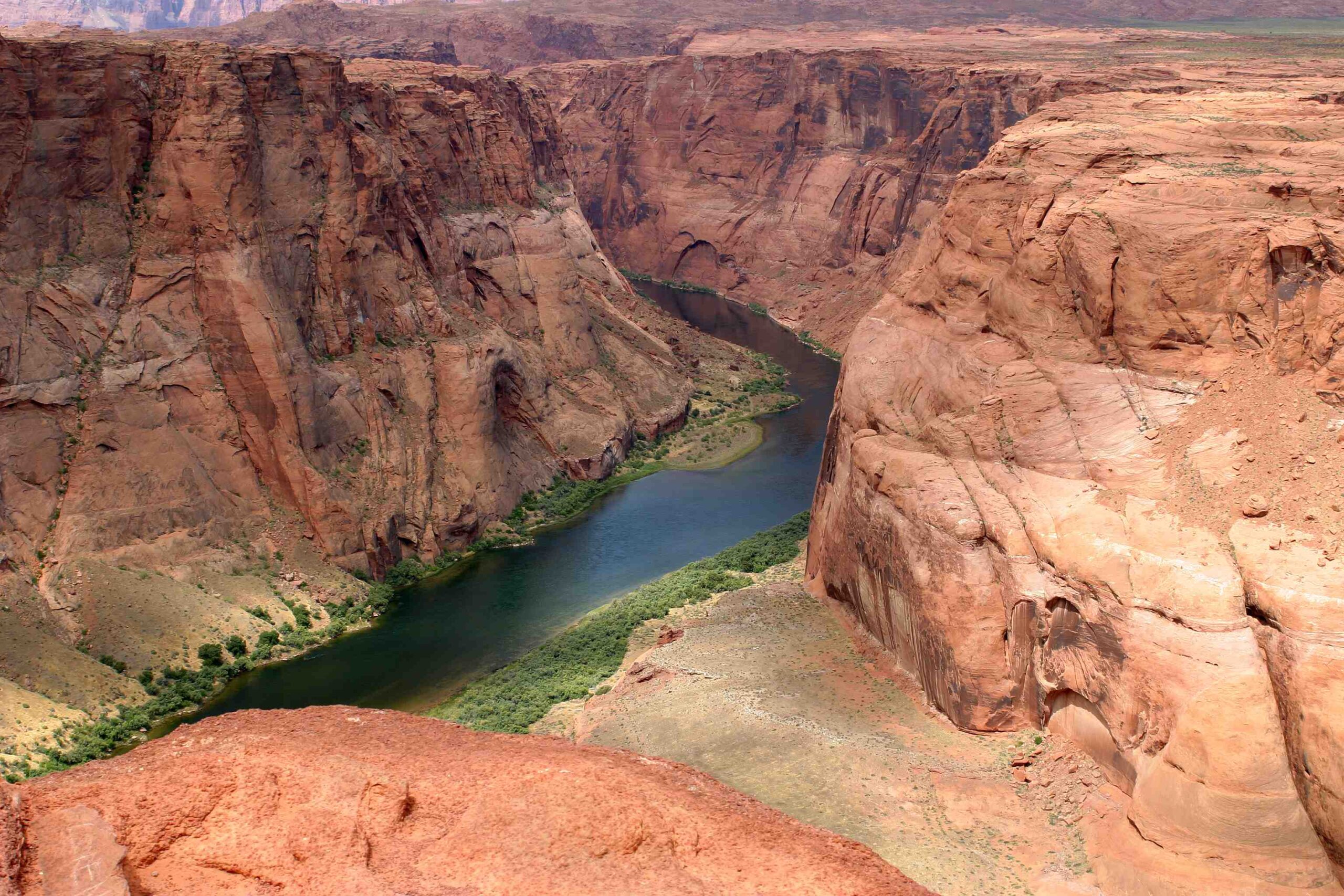
- Horseshoe Bend Overlook
-
Grand Canyon viewpoints
-
Educational Programs:
- Ranger-led talks on river ecology
- Water conservation workshops
Visitors can gain insights into the river’s flow levels and their importance to the region’s ecology and economy through these experiences.
What Future Projections Exist for Colorado River Flow Levels?
Looking ahead, several projections have been made regarding the Colorado River’s flow levels:
- Short-term Forecasts: Based on snowpack and reservoir levels
- Climate Model Predictions: Long-term scenarios considering climate change impacts
- Water Management Plans: Adaptive strategies to address potential shortages
These projections are crucial for planning and implementing measures to ensure sustainable water use in the Colorado River Basin.
How Can Individuals Contribute to Conserving Colorado River Flow Levels?
Everyone can play a role in conserving water and supporting healthy flow levels in the Colorado River:
- Practice water conservation at home
- Support water-efficient agriculture
- Advocate for sustainable water policies
- Participate in local river clean-up events
- Educate others about the importance of river health
By taking these actions, individuals can contribute to the long-term sustainability of the Colorado River’s flow levels.
In conclusion, monitoring and managing Colorado River flow levels is a complex and ongoing challenge. As climate change continues to impact water resources, it’s more important than ever to stay informed about the river’s status and work collectively towards sustainable solutions.
References:
1. https://www.cap-az.com/colorado-river-conditions-dashboard/
2. https://waterdata.usgs.gov/monitoring-location/09380000/
3. https://waterdata.usgs.gov/monitoring-location/09163500/

