The Colorado River dramatically transformed the landscape that existed before the Grand Canyon formed. Over millions of years, this powerful river carved through layers of rock, creating one of the world’s most iconic natural wonders. The process involved extensive erosion, sediment transport, and geological upheaval, turning a relatively flat plateau into a vast, intricate canyon system. This article explores the fascinating journey of how the Colorado River sculpted the Grand Canyon we know today.
What Was the Landscape Like Before the Grand Canyon?

Before the Grand Canyon’s formation, the landscape was vastly different:
- Flat Plateau: The area was primarily a flat, elevated plateau.
- Ancient Seabed: Much of the rock was formed from ancient seabeds and sand dunes.
- Volcanic Activity: Some areas showed evidence of past volcanic activity.
The Colorado Plateau, which hosts the Grand Canyon, was a relatively uniform highland with minimal topographic relief. This plateau consisted of horizontal layers of sedimentary rock deposited over millions of years, creating a cake-like structure of different rock types.
How Did the Colorado River Begin Its Erosive Process?

The Colorado River’s erosive journey began approximately 70 million years ago:
- Tectonic Uplift: The Colorado Plateau experienced significant uplift due to tectonic forces.
- River Formation: As the plateau rose, water from the Rocky Mountains began to flow across it, forming the ancestral Colorado River.
- Increased Gradient: The uplift created a steeper gradient, increasing the river’s erosive power.
This combination of factors set the stage for the river to begin its long process of carving through the layers of rock.
What Role Did Climate Play in the Canyon’s Formation?
Climate played a crucial role in shaping the Grand Canyon:
- Increased Precipitation: During ice ages, particularly 2-3 million years ago, the region experienced higher precipitation.
- Enhanced Erosion: More water meant stronger river currents and increased erosive power.
- Freeze-Thaw Cycles: Cold periods led to more frequent freeze-thaw cycles, which further broke down rocks.
| Climate Factor | Effect on Canyon Formation |
|---|---|
| Ice Ages | Increased precipitation and erosion |
| Wet Periods | Higher river volume and sediment transport |
| Dry Periods | Wind erosion and rock weathering |
These climatic variations accelerated the canyon’s formation and contributed to its unique features.
How Did the River’s Erosive Power Change the Rock Layers?
The Colorado River’s erosive power dramatically altered the rock layers:
- Vertical Erosion: The river cut downward through the layers of sedimentary rock.
- Lateral Erosion: As it flowed, the river also eroded sideways, widening the canyon.
- Differential Erosion: Softer rocks eroded faster, creating the canyon’s distinctive step-like appearance.
The river acted like a giant saw, cutting through approximately 1.8 kilometers (6,000 feet) of rock layers. This process exposed nearly two billion years of Earth’s geological history.
What Evidence Shows the River’s Impact on the Landscape?
Several pieces of evidence demonstrate the Colorado River’s impact:
- Exposed Rock Layers: The canyon walls reveal a timeline of geological history.
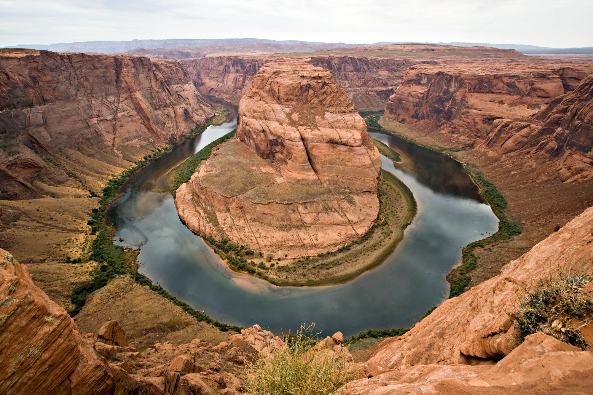
- River Meanders: The winding path of the river is preserved in the canyon’s shape.
- Sediment Deposits: Layers of river-deposited sediment can be found throughout the canyon.
These features provide a clear record of the river’s erosive work over millions of years.
How Fast Did the Colorado River Carve the Grand Canyon?
The rate of erosion varied over time:
- Average Rate: Approximately 0.3 meters (one foot) every 200 years.
- Periods of Rapid Erosion: During wetter periods, erosion rates likely increased.
- Slower Periods: Drier climates and harder rock layers slowed the process.
It’s important to note that the canyon’s formation wasn’t a constant, uniform process. It involved periods of rapid change and relative stability.
What Unique Features Did the River Create in the Canyon?
The Colorado River created several unique features within the Grand Canyon:
- Side Canyons: Tributary streams carved their own smaller canyons.
- Rapids and Waterfalls: Erosion-resistant rock layers created these water features.
- Buttes and Mesas: Isolated rock formations left behind by differential erosion.
These features add to the canyon’s complexity and beauty, showcasing the river’s diverse impacts on the landscape.
How Has Human Activity Affected the River’s Ongoing Impact?
Human activity has significantly altered the Colorado River’s natural processes:
- Dam Construction: The Glen Canyon Dam, built in 1963, has changed sediment flow and erosion patterns.
- Controlled Floods: Periodic releases from the dam attempt to mimic natural flooding.
- Tourism Impact: Increased human presence has led to erosion control measures in some areas.
These interventions have slowed the natural erosion process and changed how the river continues to shape the canyon.
What Can Visitors Learn About the River’s Role in Shaping the Landscape?
Visitors to the Grand Canyon can gain insights into the river’s role through:
- Guided Tours: Knowledgeable guides explain the geological processes.
- Viewpoints: Strategic locations offer views of the river’s path and erosive work.
- Visitor Centers: Exhibits and educational programs detail the canyon’s formation.
These resources help visitors understand the immense scale of time and forces involved in the canyon’s creation.
The Colorado River’s transformation of the landscape before the Grand Canyon formed is a testament to the power of natural processes over vast periods of time. From a flat plateau to one of the world’s most spectacular canyons, this change represents a fascinating chapter in Earth’s geological history.
References:
1. https://www.maxtour.co/how-did-the-colorado-river-help-shape-the-grand-canyon/
2. https://library.nau.edu/speccoll/exhibits/grand-canyon-100/index.php/colorado-river-geology/
3. https://knowablemagazine.org/content/article/physical-world/2019/deeper-understanding-grand-canyon

